
Geography, 09.11.2019 03:31 anayajhughes0603
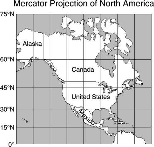
In this mercator map of north america, canada and alaska together appear larger than the united states and mexico together when in fact they are smaller. what causes this distortion?
f the map is a projection of a round world onto a flat surface.
g the latitude and longitude lines create an optical illusion.
h the northern regions are enlarged because the shallower
parts of the ocean are frozen.
j mountains get flattened on a map so that mountainous
areas look larger than they really are.

Answers: 2
Another question on Geography
Geography, 23.06.2019 08:30
What is the amount of organic matter in all living organisms in a habitat called?
Answers: 1
Geography, 24.06.2019 03:00
Technology has affected regional settlement patterns in what ways? choose all that apply. climatic improvement strategies have improved crop productivity. mechanized agricultural methods have improved agricultural productivity. participation in the global economy has increased urbanization. population shifts from urban to rural areas has increased as a result of petroleum production. settlement areas have increased as a result of improved water storage and delivery systems.
Answers: 3
Geography, 24.06.2019 17:00
What is the connection between a metalloid and a semiconductor
Answers: 1
You know the right answer?
In this mercator map of north america, canada and alaska together appear larger than the united stat...
Questions

Mathematics, 21.08.2020 01:01


Mathematics, 21.08.2020 01:01


History, 21.08.2020 01:01

Mathematics, 21.08.2020 01:01
Mathematics, 21.08.2020 01:01

Computers and Technology, 21.08.2020 01:01
Geography, 21.08.2020 01:01


