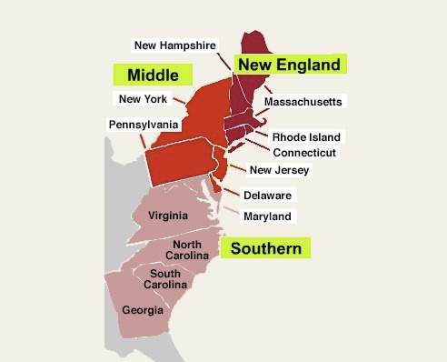
using the map image above, answer a, b, and c. a. briefly explain the historical context of this map image.b. briefly explain one economic or social development in the period 1607–1754 that could be used to explain what the cartographer (mapmaker) shows in the map image. c. briefly explain one social development in the period 1607–1754 that could be used to explain the distinctions shown in the map image.your responses: a.during this time period the colonies had recently been formed by the british. the colonies were grouped into three sections based on common beliefs, lively hood, and how they interacted. the new england colonies had passed the mayflower compact and they focused on trade, shipbuilding, and fishing. the middle colonies had purchased land from the native americans and dealt mostly with the export of wheat, banking, and shipping.
hope this