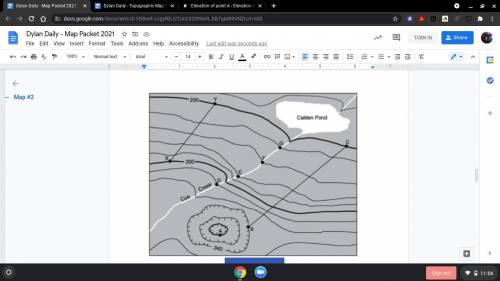
What is the contour interval of this map?
What is the elevation of each point?
A
B
C
D
E
F
G
X
Y
If you were to walk from point B to point C, how would your elevation change?
What direction is Coe Creek flowing?
If you were to walk from point Y to point X, how would your elevation change?